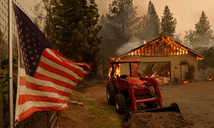
Firefighters battling flames in northern California were preparing for fresh bouts of windy weather, as a utility warned it might cut electricity for thousands of people to prevent new fires from igniting.
Conditions that suppressed the huge Dixie fire overnight were expected to give way late in the day to winds that could push flames toward mountain communities, in a region where drought and scorching summer heat have turned vegetation to tinder.
Information officer Jim Evans said: “In this environment, any type of wind, no matter what direction – especially the way the fire’s been going – is a concern for everyone.”
The Dixie fire has scorched 890 sq miles (2,305 sq km) in the northern Sierra Nevada and southern Cascades since it ignited on 13 July and eventually merged with a smaller blaze called the Fly fire.
More than 1,100 buildings have been destroyed, including 625 homes, and more than 14,000 structures remained threatened.
Numerous evacuation orders were in effect.
Pacific Gas & Electric has notified utility regulators that the Dixie and Fly fires may have been caused by trees falling into its power lines. The Dixie fire began near the town of Paradise, which was devastated by a 2018 wildfire ignited by PG&E equipment during strong winds. Eighty-five people died.
On Sunday evening, PG&E notified 39,000 customers that it may have to shut off power Tuesday evening due to a forecast of dry winds out of the north-east.
It said: “Given this wind event and current conditions including extreme to exceptional drought and extremely dry vegetation, PG&E has begun sending 48-hour advance notifications to customers in targeted areas where PG&E may need to proactively turn power off for safety to reduce the risk of wildfire from energized power lines.”
The Dixie fire was among 97 large, active wildfires burning in the United States on Monday, the National Interagency Fire Center said.
More than 25,000 firefighters, support personnel and management teams were assigned to the blazes.
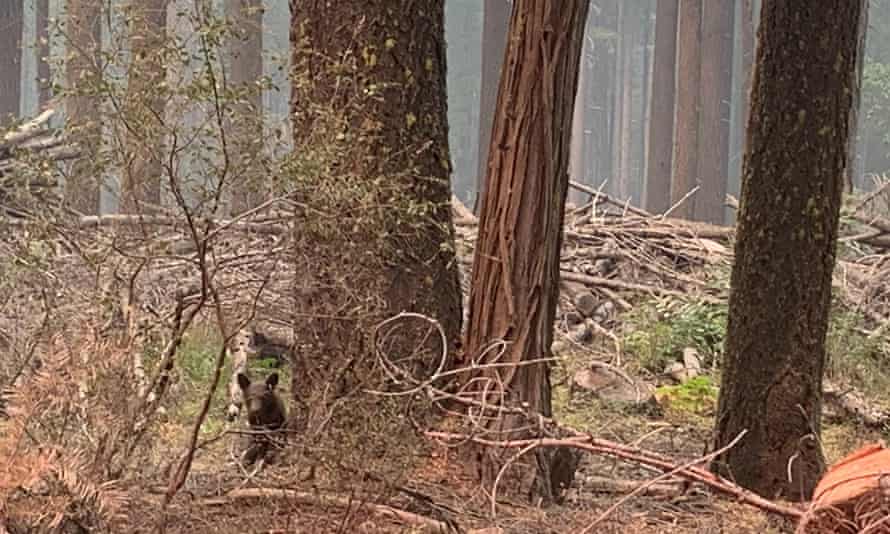
Meanwhile, firefighters are keeping an eye on an emaciated bear cub that may have lost its mother to the Dixie fire.

The cub was seen rambling solo along a burned mountain road near Taylorsville, peering through brush and leaping through plants covered in fire retardant chemicals.
“Generally when you see them with a sow or a mother bear, they’ll stay with the mother bear and run off,” said firefighter Johnnie Macy. “This bear hasn’t done that, so because of that we think that the bear’s orphaned as a result of the fire.”
Macy called the situation “heartbreaking,” but said it is “Mother Nature taking its course”.
Over the weekend, Greenville, the small Gold Rush-era town that was burned 10 days ago, lay in ruins, with much of the town reduced to piles of bricks and heaps of metal, frozen in tones of grey and black. The only color among the haze was an American flag – saved during the flames – that had been taped to the remnants of a fallen building.
The destruction stretched for miles along State Highway 70, which snakes through the mountains along the Feather River. In place of the lush forested canopy, blackened spikes stretched into the smoky sky over an ashen moonscape, as the orange haze reflected in the sparkling river below.
Since igniting last month, the Dixie fire has ravaged nearly 867 sq miles, an area the size of Tokyo. It was 31% contained on Sunday.
The Dixie fire was the largest among more than 100 big blazes in more than a dozen states in the west, a region seared by drought and hot weather that turned forests, brushlands, meadows and pastures into tinder.
Climate change has made the region warmer and drier in the past 30 years and will continue to make the weather more extreme and wildfires more destructive.
A few hundred miles to the south of the Dixie fire, evacuations were ordered after a blaze that broke out the night before churned through California forestland near the remote community of Omo Ranch. There was no containment of the Caldor fire burning in El Dorado county, about 60 miles east of Sacramento.

In south-eastern Montana, firefighters gained ground on a pair of blazes that chewed through vast rangelands and at one point threatened the Northern Cheyenne Indian Reservation. Those fires were caused by heat from coal seams, the deposits of coal found in the ground in the area, said Peggy Miller, a spokeswoman for the fires.
Smoke also drove air pollution levels to unhealthy or very unhealthy levels in parts of northern California, Oregon and Idaho.


Average Rating